
VAL D’ISÈRE PISTE MAP
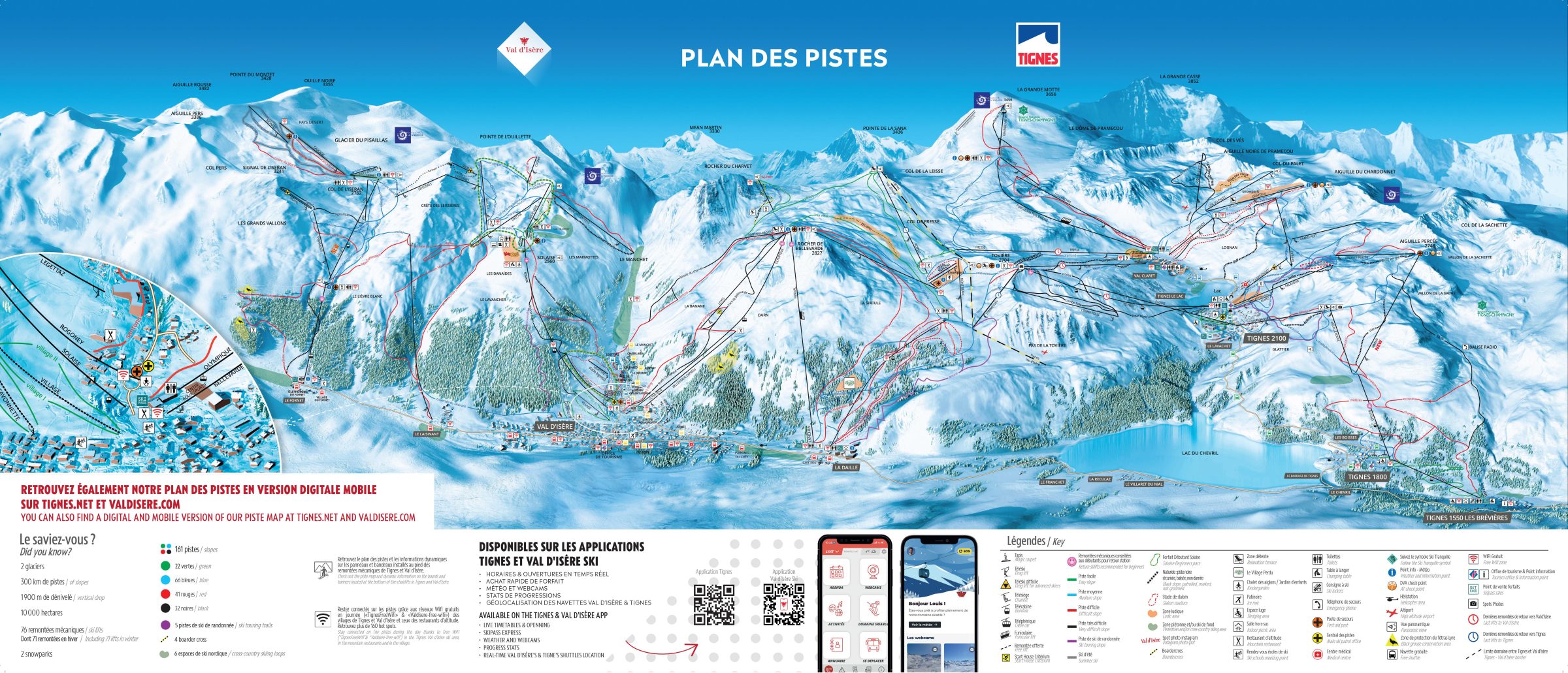
The vast Val d’Isère and Tignes combined ski area in France is one of the best in the world. It stretches from Val d’Isère’s Glacier du Pisaillas, at the top left of the piste map, via the Glacier de la Grande Motte in Tignes, and extends all the way to its lowest point in the village of Tignes Les Brevières, at 1550m, at the bottom right of the piste map. Val d’Isère’s highest lift reaches 3197m, while the Grande Motte cable car in Tignes climbs to 3456m.
Select the link below to view the interactive piste map of the full Val d’Isère and Tignes ski area. Click the ‘x’ on any piste or lift for pop-up information giving its name, length, vertical drop, etc, and – extremely useful while you’re in the resort – whether it’s open or closed in real-time.


